|
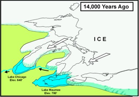
14000 years ago the entire Great Lakes lowlands were under a glacier that began to recede at the end of the Ice Age |
|
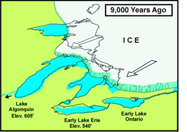
As the glacier receded, it left indentations in the ground that began to fill up with the water melting off of the glacier |
|
|
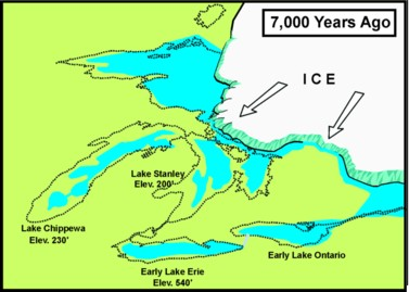
As the glacier continues to recede more indentations are made and filled and start to become visible as the Great Lakes of today |
|
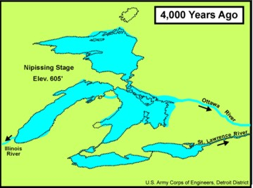
The glacier has fully receded and the Great Lakes are completely filled and are completely recognizable as the current Great Lakes. |
|
